Urgent Alert: Typhoon Uwan Intensifies to Super Typhoon, Massive Evacuations Underway
Last Updated on 02/07/2026 by Helal Medical
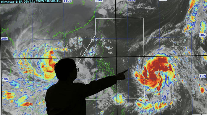
The weather situation in the Philippines has rapidly escalated. As of Sunday morning, November 9, 2025, Typhoon Uwan (International Name: Fung-Wong) has intensified rapidly. This forced authorities to raise the highest possible warnings across affected regions.
This massive Philippines typhoon is now a serious threat to life and property, requiring immediate public action.
Urgent: Typhoon Uwan Upgraded to Super Typhoon
According to the latest PAGASA update, Typhoon Uwan has officially been classified as a Super Typhoon.
The severity of the storm has spiked overnight:
- Intensity:
Peak sustained winds are reported at 185 km/h near the center. Dangerous gusts are reaching up to 230 km/h. - Warning Level: Tropical Cyclone Wind Signal (TCWS) No. 4 is now raised in parts of the Bicol Region, signaling severe threat.
- Location:
The center of the storm is close to or grazing the coast of Catanduanes. It is bringing catastrophic winds and havy rainfall to the region. PAGASA Severe Weather Bulletin (7:00 AM, Nov 9, 2025).
Landfall and Evacuation Timeline
The danger is imminent. The Office of Civil Defense (OCD) confirms that all preparedness measures are at a critical stage.
- Direct Threat:
The storm’s eye is forecast to make landfall. It will hit the provinces of Aurora or Southern Isabela late Sunday evening. It can also happen early Monday morning. OCD is keeping a close watch on the potential super typhoon – PNA. - Mandatory Evacuation:
The OCD urged local government units (LGUs) to complete all preemptive evacuations by Sunday morning. This will guarantee residents in high-risk areas are moved to safety before the most severe weather arrives. LGUs in Uwan path told to finish evacuation by Sunday morning – PNA. - Widespread Impact:
The Super Typhoon is so large. A vast area spanning from Northern Luzon down to the Visayas is expected to experience heavy rains. Strong winds and storm surges are also expected.
Secondary Hazard: Lahar Threat from Mayon Volcano
The wind and flood threat is significant. Additionally, the Philippines Institute of Volcanology and Seismology (PHIVOLCS) issued an urgent warning for areas around Mayon Volcano.
The torrential rainfall expected from Typhoon Uwan can trigger dangerous lahar (volcanic mudflows). These mud-flows can erode loose volcanic deposits from the 2018 and 2023 eruptions. They pose a major risk to communities downstream in Albay. Lahar threat looms over Mayon as Typhoon Uwan batters Bicol, warns Phivolcs – MB.
Conclusion and Action Summary
Typhoon Uwan is now an extremely powerful Super Typhoon that requires immediate and serious attention. Residents in Signal No. 4 and other high-risk zones must heed evacuation orders. Do not wait for conditions to worsen. Stay indoors, check official weather bulletins, and prepare for widespread power outages and flooding. Your preparedness is critical in surviving this dangerous Philippines typhoon.
Discover more from Helal Medical Manila
Subscribe to get the latest posts sent to your email.